
The marsh edge and the next street
At the upwind edge of a subdivision facing open marsh, Laura stripped roofs to the decking. One street downwind, roofs were largely intact. A 1 km catastrophe model gives both streets the same wind.
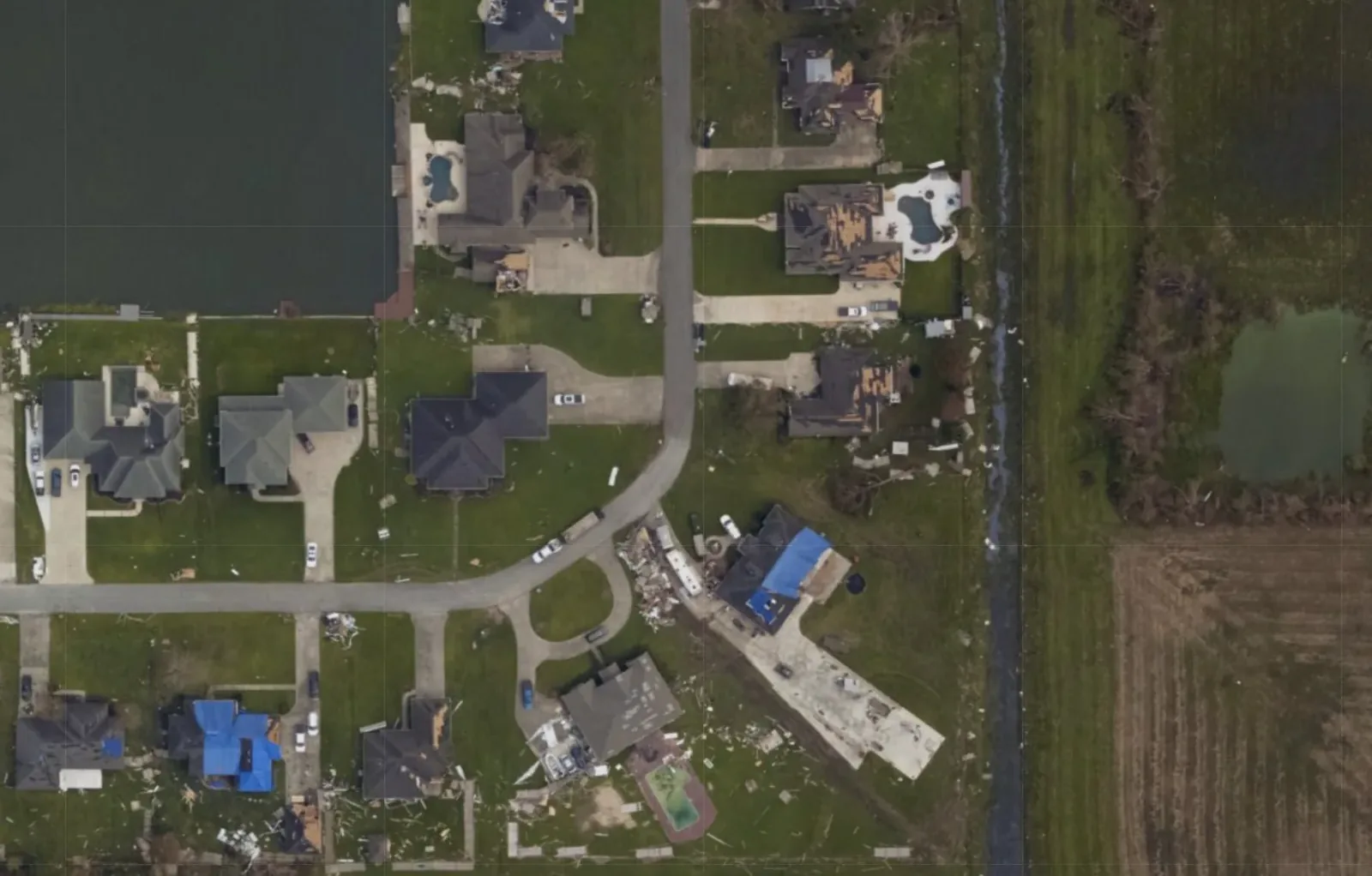 Wind from the east
N
Why the two streets fared differently
Wind near the ground is set by what it has just crossed. Over the marsh it stays fast close to the surface. Behind the first row of roofs it is slower and more turbulent, and the second row stands in that air.
Under building codes, design pressure on the same house is about 50% higher in open terrain than in a suburban setting.1
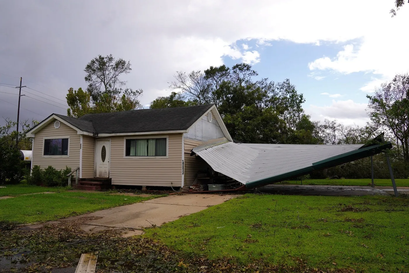
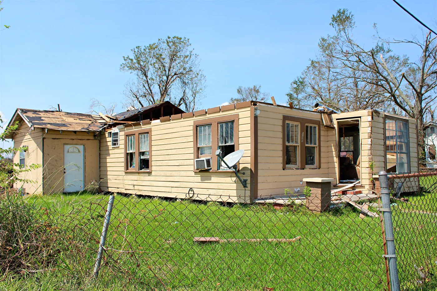
Elsewhere along Laura’s path, damage was just as uneven from lot to lot.
×1.24
A susceptibility modifier for this street
A 1 km model gives one value for this street. A susceptibility modifier would give thirteen, above 1 along the marsh edge and below 1 in the second row.
The values shown are illustrative, and are not model output or a claim about these homes.
“When I look at post-event imagery, like this residential block after Hurricane Laura, I see evidence that these effects really matter: houses fronting an open expanse see their roofs ravaged while those deeper in the development appear sheltered.”
Ted Amdur, announcing Downstream, September 2026.
Sources
- ASCE 7‑22, Table 26.10-1.
Get in touch
We love feedback. If you’re working through interesting problems in wind risk, let’s chat.
Updates by email
Sign up for monthly updates, new research releases, and live event analysis